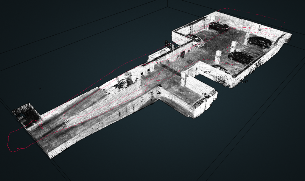
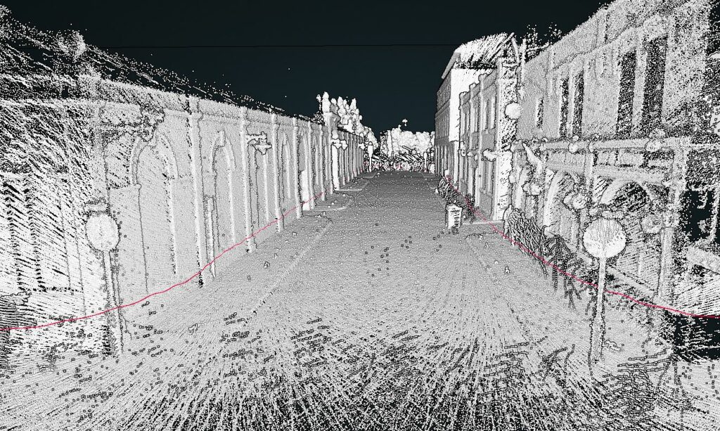
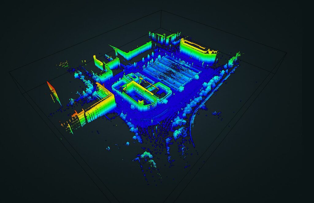
UrbanARK explores the use of aerial LiDAR scanning (ALS) as well as terrestrial static LiDAR Scanning and mobile LiDAR scanning (MLS) for capturing urban fabrics at streetscape level and identifying the location and geometry of underground spaces to enhance urban coastal flood prediction models and flood risk communication tools. This page illustrates examples of ongoing research work across the three case study areas in Belfast, Dublin and New York and provides links for accessing available data and project publications.
Publications
Vo, AV, Hewage, CNL, Russo, G, Chauhan, N, Laefer, DF, Bertolotto, M, Le-Khac, NA & Oftendinger, U. (2019). Efficient LiDAR point cloud data encoding for scalable data management within the Hadoop eco-system. in C Baru, J Huan, L Khan, XT Hu, R Ak, Y Tian, R Barga, C Zaniolo, K Lee & YF Ye (eds), Proceedings – 2019 IEEE International Conference on Big Data, Big Data 2019., 9006044, Proceedings – 2019 IEEE International Conference on Big Data, Big Data 2019, Institute of Electrical and Electronics Engineers Inc., pp. 5644-5653, 2019 IEEE International Conference on Big Data, Big Data 2019, Los Angeles, United States, 12/9/19. https://doi.org/10.1109/BigData47090.2019.9006044
Vo, AV, Laefer, DF, Trifkovic, M, Hewage, CNL, Bertolotto, M, Le-Khac, NA & Ofterdinger, U. (2020). ‘A highly scalable data management system for point cloud and full waveform Lidar data’, International Archives of the Photogrammetry, Remote Sensing and Spatial Information Sciences – ISPRS Archives, vol. 43, no. B4, pp. 507-512. https://doi.org/10.5194/isprs-archives-XLIII-B4-2020-507-2020
Gmelch, P., Lejano, R., O’Keeffe, E., Laefer, D. F., Drell, C., Bertolotto, M., Ofterdinger, U., and McKinley, J (2020). “The Case for Low-Cost, Personalized Visualization for Enhancing Natural Hazard Preparedness”. ISPRS – International Archives of the Photogrammetry, Remote Sensing and Spatial Information Sciences XLIV-M-2-2020 https://doi.org/10.5194/isprs-archives-XLIV-M-2-2020-37-2020. https://par.nsf.gov/biblio/10205033.
Peng, Y., Ofterdinger, U. S., Miller, A., Meneely, J., McKinley, J., Laefer, D., & Bertolotto, M. (2022). Numerical simulation of the coastal flooding in urban centres with underground spaces. In M. Ortega-Sánchez (Ed.), Proceedings of the 39th IAHR World Congress (pp. 7103-7109). (IAHR World Congress: Proceedings). https://doi.org/10.3850/IAHR-39WC2521711920221660
Miller, A., Ofterdinger, U., McKinley, J., Meneely, J., Bertolotto, M., & Laefer, D. (2022). Enhancing flood risk management for urban coastal communities using handheld mobile LiDAR. In Geospatial world forum 2022: proceedings https://geospatialworldforum.org/2022/proceedings.asp
Vo, A. V., Bertolotto, M., Ofterdinger, U., & Laefer, D. F. (2023). In search of basement indicators from street view imagery data – An investigation of data sources and analysis strategies. KI – Künstliche Intelligenz. https://doi.org/10.1007/s13218-022-00792-4
Vo, A. V., Bertolotto, M., Le-Kha, N.-A., Laefer, D., & Ofterdinger, U. (2024). Flood risk assessment via innovative geospatial data usage. UrbanARK – a community-oriented resilience project. GIM International, 38(4), 36-39, https://www.gim-international.com/content/article/flood-risk-assessment-via-innovative-geospatial-data-usage
Dublin
Belfast
LiDAR scanning of underground structures in Belfast City Centre.
Pedestrian underpass from ‘Line of Duty’ BBC series

Internal Scan of Underground Car Park using mobile GeoSLAM ZEB Horizon scanner.
Mobile LiDAR Scanning using the GeoSLAM ZEB Horizon scanner. 10 minutes scanning of Queen’s University Campus.


Brooklyn, New York
LiDAR Scanning below-ground New York Transport Museum using mobile GeoSLAM scanner
Terrestrial Static LiDAR Scanning at 31st and 4th Avenue Brooklyn – 3D Model
Terrestrial Static LiDAR Scanning Jay St / Willoughby St – 3D Model

